

The first thing to know about Namibian roads is that they are only asphalted in the larger towns. As you head out into the countryside, they switch abruptly to gravel roads of varying quality. Despite that, an untroubled self-driving circle tour is possible – and recommended! So, here are a few tips for planning your trip:


Namibia has plenty to offer for a self-driving circle tour. It only takes getting used to the left-hand traffic and learning not to activate the windshield wipers at every turn, because here the turn signal lever happens to be on the right side of the steering column and not the left like it is with us.


Rental car and fuel consumption
My recommendation for your circle tour: rent a big SUV, because you will frequently be driving on more or less rough gravel roads. Hours bumping along are easier to take in a comfortable vehicle. And with noontime temperatures hovering around 35 degrees (centigrade), a capable air conditioner is a must item..
Katja und I splurged on a big Toyota Fortuner 4×4. It easily seats four adults and has plenty of room for several weeks worth of luggage. This is the model that we saw most en route.
So, we are not alone in valuing its comfort and suspension.

With a full tank, the Fortuner’s onboard computer will indicate a range of about 840 kilometers (520 miles). That seems like a lot, but with Nambia’s vast distances, mapping a solid fill-up plan will keep your range anxiety in check.
As you might expect, the SUV’s mighty 2.8-liter engine is quite a guzzler. Starting out in ours, I could soon feel the range anxiety rising in me on seeing how quickly the fuel gauge moved in the direction of zero: the first hour of driving alone used up a quarter tank!
Fortunately, the gauge’s operation appears to be not quite linear; evidently, the tank was not quite full when we got behind the wheel.
In eco mode, per 100 km (62 miles), the Fortuner consumed 8.1 liters (2.1 gallons) diesel on asphalt and 8.6 liters (2.7 gals.) on gravel.


When picking up the rental car, insist on them showing you the spare wheel: In case the sharp stones on the gravel roads take their toll on a tire, you need to know how to extract the Toyota Fortuner’s heavy spare wheel from its bracket through a small hatch. I certainly would have had a hard time figuring it out.
1 liter (4 liters = ca, 1 gallon) costs 14.30 Namibian dollars. That’s about 96 cents US (as of October 2021) per liter, i.e., a few cents less than $4 US per gallon.
We covered a total distance of just over 1,500 km (about 930 miles) on the stretch from Swakopmund through Etosha National Park to Windhoek:
- ca. 500 km (310 miles) on asphalted roads
- ca. 1,000 km (620 miles) on gravel
- with € 117 ($136 US) spent on diesel
Filling stations between lodges and camps
When we scouted our routes with Google Maps, the app did not pinpoint all existing filling stations. This only increases the range anxiety.
But, as it turned out, with a good plan there is no obstacle to a carefree self-driving circle tour, simply because there are actually more open filling stations than expected. They all accept credit cards – except for the run-down state-owned filling station in the Etosha National Park.
You can easily avoid this stop, however, because when approaching from the west (on a clockwise circle tour), you can fill up just before the Etosha National Park’s Anderson Gate at the modern Etosha Trading Post. Coming from the south (counterclockwise circle tour) the Puma filling station just before the national park’s entrance is the place to fill your tank.


The crew at the Puma filling stations turned out to be my local heroes: an attendant, Dennis by name, with big gestures, already directed me from far away to the next open pump, making me feel like a Formula 1 driver. If only he’d waved a checkered flag, the illusion would have been complete!
While Dennis let the diesel gurgle into the tank, his colleague busied himself with washing the car windows and dusty windshield wipers. He had to hustle, because the Fortuner has quite an expanse of window glass.
I never felt so good about tipping somebody as with these two fellows ;-) I gave them each 20 Namibian Rands (actually South African Rands, which are still legal tender here from the time Namibia was under South African rule until 1990) equal to about $1.40 US. Is that a lot of money to them? anyone know?
Filling stations between Swakopmund and Twyfelfontein (Damaraland)
To ease your mind on starting the circle tour, I recommend filling up in Swakopmund. We did, because to our first stop at Mowani Mountain Camp in Damaraland, Google Maps displayed a distance of 329 km (204 miles).
While it would have been possible to get there without stopping to tank up, the problem was that Google after Damaraland only flagged a filling station much later on the next hundreds of kilometer to Etosha. That could make it too tight for comfort.
The filling stations indicated on the app after Swakopmund near Hentiesbay moreover are not located right on the C34 main road. Because the tank was still three-quarter full at this point, it made better sense to keep driving until Uis. In this hamlet, you will find a a well-equipped Engen filling station with store.
Be sure to notice the improvised “Manassa Carwash” across the street, consisting of 4 stakes and a tub of water. ;-)


Filling stations between Damaraland and Etosha National Park (Anderson’s Gate)
On this 330 km (205 miles) segment, we got no hits with Google Maps’ “Filling Stations” function.
However, it turned out that in Khorixas a good Engen filling station is located directly on the road, and Outjo, a fairly sizeable town, is sure to have filling stations.
A few kilometers before the western Anderson’s Gate of Etosha National Park the modern filling station of the Etosha Trading Post with its large store is a welcome sight.


Filling stations in Etosha National Park: between Anderson and Von-Lindequist Gates
On this 181 km (112 miles) segment between the southern and eastern entrance gate of Etosha National Park, Google Maps again draws a blank on filling stations.
In reality, besides the Etosha Trading Post’s filling station, there are filling stations in each of the Park’s Visitor Centers in Okauquejo and in Camp Halali.
Okauquejo is an obligatory stop in any case, because this is where the park fee must be paid. For 350 Namibian dollars (ca. 21 euros or $24 US) two people can spend 24 hours in the park.
Just as at the part entrance, the sum is entered neatly by hand in a thick ledger. It occurs to me that they have no way of checking at the park exit who was where for how long…
You will find another filling station Namutomi near the Von Lindequist Gate, As described earlier it looks run-down and the lone attendant will not accept credit cards.
The adjoining outhouse toilet is modest but clean, however.


Filling stations between Etosha National Park and Okonjima Nature Reserve
If you drive the circle tour in counterclockwise fashion, you will do well to fill up for this 356 km (220 mile) portion at the Puma Service Station at Tsumeb. That’s where station attendant Dennis and his boys give it their all to make filling up a happening!
A Shell station also awaits the thirsty 4×4 SUV at Otjiwarongo.


Filling stations between Okonjima Nature Reserve and Windhoek
The 224 km (139 mile) stretch to Windhoek has many filling stations: There are several already in the little town of Okahandja and quite a few to choose from in Windhoek in any case.
Tip: It is 47 km (29 miles) from Windhoek to Hosea Kutako International Airport. If you drop your rental car off at the airport, you can top off the tank right at the airport’s Puma filling station.
I filled up in Windhoek and drove “with a light foot” to the airport. The Toyota’s fuel gauge cooperated by remaining on “full” for the entire 80 km (50 mile) drive to the airport drop off point.


Navigate with Google Maps, ditch the Garmin
Incidentally, forget about taking the offered Garmin navigation device: it repeatedly showed us the wrong turn-offs, causing us to rely entirely on Google Maps.
Because of the great distances in Namibia, we did not have service everywhere with a prepaid SIM card bought in-country, so downloading the Google Map locally to your smartphone is advisable.
Prepaid cards are available on arrival at the Windhoek airport for about 8.50 euros ($10 US), valid for two times one week with a 1 or 2 gigabyte data packet.
We only used a fraction of that, since lodges and restaurants even in remote locations offer WiFi and we downloaded the respective Google Maps on the WLAN to our phones before each departure.
More pictures of Namibia roads
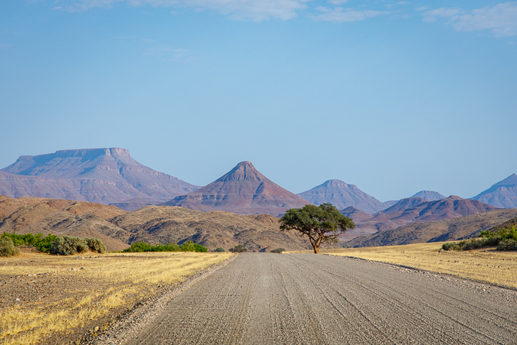
Contrary to the supposedly monotonous desert savannas, driving in Namibia you don’t have to wait long for the landscape to change drastically.
Katja and I highly recommend a self-driving circle tour.


Recommended: self-driving tour/aerial safari combination
We started this circle tour with an airborne safari from the Windhoek Eros Airport to the airstrip of the Wolwedans Dune Lodge in Sossusvlei and return from the airstrip of Little Kulala Lodge (see our article here) to Swakopmund, where we picked up the rental car for the rest of the tour as described above.


