The Eiger panorama trail is one of many hikes around Grindelwald First. It promises an overwhelming view of the Eiger north face — so long as the weather cooperates…
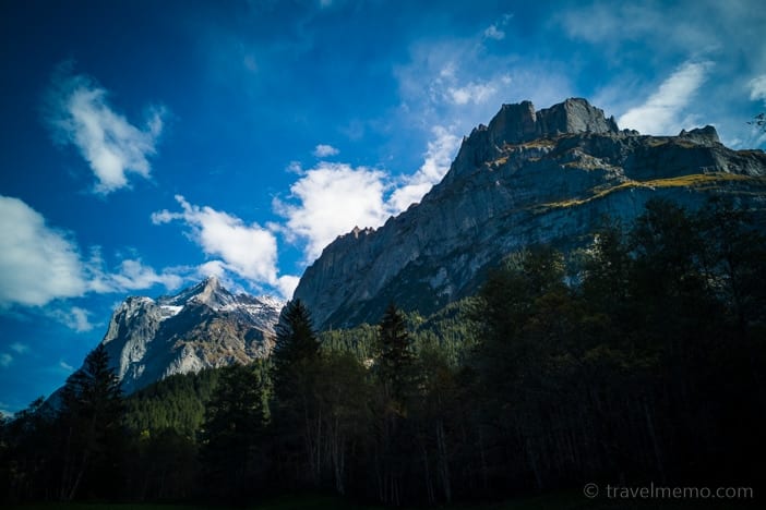
With the imposing mountain scenery of the Eiger and the Wetterhorn surrounding it, Grindelwald in Switzerland’s Bernese Oberland (highlands) is a hiking paradise. Up to mountain peaks or mountain lakes, into valleys or along streams — you’ll find the Jungfrau region offers plenty of hiking trails to choose from.

A hiking paradise
Ah, yes, the agony of choice. But we decided to take the advice of friends and chose the Eiger panorama trail on the First.
Early on a beautiful autumn morning, we set out from our lodgings – the Glacier Boutique Hotel in Grindelwald – to make our way to the Firstbahn cableway. One of its six-seater gondolas lifts us from Grindelwald via Bort and Schreckfeld up to the First, the trailhead for various hikes. As the first clouds start moving in…
Adventures under the clouds
First is also an Eldorado for anyone looking for an adrenaline rush at this airy elevation: for one, there are the two flying fox versions (First Flyer and First Glider) which let you zoom down the mountain side strapped into a sturdy harness at speeds up to 50 miles per hour.
There is also the lookout platform of the First Cliff Walk by Tissot, an adventure all its own!
Regrettably, the weather turned bad on us within minutes – which happens often in the mountains — and obscuring much of the golden autumn day. All we had before our eyes were clouds and patches of fog.
Forget about vistas or panoramas. Nothing. We nevertheless ventured onto the partly glassed-in First Cliff Walk.
Slightly bummed out by the weather having deserted us, we set out next toward the lake called Bachalpsee. Maybe the sun will show itself again in a mountain minute after all?
The Eiger panorama trail: From First via Bachalpsee to Bussalp
It takes about 50 minutes to hike to the Bachalpsee lake. As trails go, it is an easy one favored by many Asian visitors. After all, they heard about how idyllic the lake is or saw pictures on Instagram and naturally that makes it a choice selfie destination.
As we stride along, I send a few quick prayers heavenward, hoping that St. Peter will hear at least one of them and favor us with a little sunshine…please!
Suddenly, the sky brightens as the clouds part to let the sun peek through. St. Peter answered!
Here comes the sun…
A few rays of sunshine at that moment magically paint a picturesque scene of shafts of light piercing the shadows. Now a breeze comes up, which makes the sky change from minute to minute, with sun and clouds alternating as if competing with each other.
As we reach the lake, it brightens up even more and we take a few terrific photos. This mountain lake lies at 7,431 feet above sea level, surrounded by an imposing moor landscape.
…and the fog
While the Asian tourists photograph the lake from all possible vantage points, we continue on between the two Bachalpsee lakes to our next way point, the Hireleni Pass. And suddenly the fog moves in again – to wrap everything in mystery.
From here we expected to get a matchless panorama view of the Grindelwald Valley and of the Bernese Alps with the Eiger north face.
Seven of the peaks here are over 13,000 feet. We see simply… a whole lot of nothing, however! other than the hills through which the trail leads – and rocks that resemble Moai figures.
A challenging side trail
On Hireleni Pass a narrow mountain path runs along the ridge in direction Rötigipfel. In a few places, it is quite exposed and should only be tackled by experienced, surefooted alpinists. We did not sight any more Asians hikers, in any event.
The rest of the way it descends gradually. In the Bonera, we traverse a small stream, the Bussalpbach, and then continue on to the Bussalp by way of Oberläger.
Here we concluded our interesting and exciting hike by catching a ride on the Grindelwald bus into the valley to the train station there.
Information on the Eiger Panorama Trail
Route: First – Bachalpsee – Hireleni-Pass – Bonera – Bussalp
Distance: 5.2 miles
Climb: 1,000 feet, descent: 2,200 feet
Time to hike: 3 hours 15 minutes
Difficulty: T2.
View: with good weather, it’s sensational! when it’s cloudy, it’s kind of mystical.
Food: from the backpack. The only places that serve food are the mountain restaurants at the starting point (First Mountain Inn) and at trail’s end on the Bussalp.
Or the reverse, for those who start by taking the mail bus to the Bussalp. Going this way means starting the hike with the long climb and ending it with the easy segment from Bachalpsee to the First. Easier on the knees.
Grindelwald Glacier gorge
Another tip for a Grindelwald excursion is the Glacier Gorge. The white water Lütschine emerges from the mountains at the foot of the Eiger north face. The melt water from the lower Grindelwald glacier has carved itself a spectacular way through the rock. A must-visit! Here is our blog post complete with pictures.
Where to stay in Grindelwald
If you are looking for modern yet informal lodgings in Grindelwald, we can recommend the Glacier Boutique Hotel – after all, the name alone goes with the glacier gorge. ;-)